NCC: Land Lines – How AI can benefit conservation

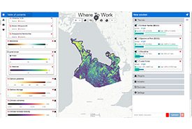
The Where to Work tool that allows users to set priorities on parameters such as (biodiversity, climate and ecosystem services) and receive a visualization of potential areas that is suitable for the goals we want to achieve.(Screenshot courtesy of NCC and Carleton University)
AI, or artificial intelligence, is in the news a lot lately. The stories range from very positive to doom and gloom. With all the talk about AI these days you might wonder, does AI play a role in the work that the Nature Conservancy of Canada (NCC) does?
The answer to that question is yes. It plays a role now and will play an even bigger role in the future as we, as an organization, embrace how technology can help us accelerate conservation. We are in the midst of a multi-year project that we call the Conservation Technology Strategy. This will help us be more efficient in our monitoring efforts and send people to the places that need eyes on them the most.
In the strategy, we are enhancing our technology foundation (e.g. servers and databases) to get us ready and nimble for future technology developments. We are also substantially expanding the data and information that we have available for our conservation work. At the same time, we are making this information available to others as much as we can. Finally, we are building open-science tools that enable NCC and others to use these databases and foundational pieces to accelerate conservation.
How are we using AI? First, through tools that we have co-developed with researchers at Carleton University. The tools are conservation decision support tools that help us determine where we should focus our efforts across Canada. They also help us determine what conservation actions work best in a specific situation.

In the same way you make choices based on budget and priorities at a grocery store, so do conservation organizations when deciding areas of work (Photo by Michael Burrows via Pexels)
Imagine a grocery store; when you head in, you might have a budget. On a particular shopping trip, you might be looking to purchase the most nutrient-dense foods and get the most bang for your buck. In the same way, this conservation tool can help us find areas of high biodiversity and are connected, adequate, representative and effective (read more about the CARE principles my previous blog). Behind the scenes of a nice user interface on the web operates a powerful algorithm that helps us in this work. That algorithm runs AI to best inform our decisions through something that’s called machine learning.
The second example is work in progress with a different group of researchers at Carleton University. For this project, we are using satellite images that are analyzed through AI to help us understand what land cover is in a place that we might never have been to access. This approach will also help us determine how the land and vegetation change over time. This will allow us to monitor what’s happening at NCC properties from our desks. If the tool alerts us to something that needs further investigation, we then visit that property to find out what’s going on.
We look forward to continue developing and improving these tools, and using them to build efficiencies and accelerate conservation work in Canada.


