Weather forecasts are less accurate because of Covid-19, a new study reveals
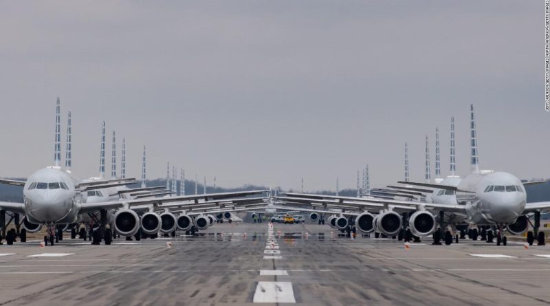
The study found that the “accuracy of surface meteorology forecast in March-May 2020 decreases remarkably” as flight density drops due to Covid-19.
The research examined weather forecasts from March 2020 and compared them to actual observed weather in the same time frame.
“It is the temperature forecast where accuracy went down,” says Chen. Patterns of hot and cold air are critical in hurricane formation and prediction. If temperatures cannot be tracked accurately, it could be more challenging to identify hotspots early on.
The forecasts that meteorologists create for hurricanes rely in part on computer models. These models are only as good as the data that is put into them.
This data comes from a variety of tools, including aircraft, cruise ships, satellites, buoys, weather balloons, ground stations, and radar. The Covid-19 outbreak has significantly reduced the amount of data we get from two of those tools — aircraft and cruises.
More importantly, meteorologists find themselves at a greater disadvantage, especially over water, where these observation tools are already limited. Over land, they can just launch extra weather balloons or add additional ground stations to help make up the loss of flight data.
But they can’t do that over water. Buoys are unevenly distributed and are notorious for data errors. These floating devices alone can’t provide a complete and accurate picture of a particular region of the ocean. Meteorologists need the combination of all available tools to accurately understand the state of the atmosphere across the globe at a given point in time.
How it affects forecasts
One way to make up for some of that data loss is having other observation tools gather additional data.
“When the National Weather Service is anticipating high impact weather events, such as a possible tornado outbreak or a potential landfalling hurricane, (it) will usually conduct ‘special’ weather balloon launches to take additional weather measurements in the upper levels of the atmosphere,” explains Kyle Theim, a meteorologist with the NWS in Atlanta. “The accuracy and precision of our weather models are paramount, and these additional observations can then help weather models and forecasters predict how extreme weather events will unfold.”
“We find that the reconnaissance soundings have significant beneficial impact.” Data collected by hurricane hunter reconnaissance flights is especially effective and can help make up the loss caused by the drop in commercial flights and cruises.
This is especially important for tropical systems where temperature and wind observations are fundamental in getting a more accurate forecast.
Forecasts were better and worse in different areas
The study found that the differences vary by location. Remote areas like Greenland and Siberia saw the greatest issues with lower flight numbers.
“This is because assimilation of aircraft observations provides a much larger improvement in forecasts over regions where very limited conventional observations are available,” says the study. It is already difficult to forecast for these remote regions, so the loss of flight data has a greater impact.
A similar effect hurts forecasting in the Southern Hemisphere.
“Degradation of the weather forecast is more substantially in the Northern Hemisphere than the Southern Hemisphere,” says Chen. The Northern Hemisphere has more population and significantly more flights than the Southern Hemisphere. A drop in flights over the Northern Hemisphere is consequently more impactful on the ability to accurately forecast the weather.
Forecasts could get worse
The results of the study actually go against normal predictions of accuracy improvement over time.
“A similar analysis for February 2020 suggests that the forecast accuracy of surface meteorology could have been expected to improve in 2020 compared with 2017-2019, if aircraft observations were carried out as usual,” the study says. This hit to accuracy comes at a time when Covid-19 is exacerbating the effects of severe weather on vulnerable populations.
The research warns that the issue of accuracy will only get worse as the Covid-19 pandemic continues.
“Further worsening of weather forecasts may be expected and that the error could become larger for longer-term forecasts,” says Chen. “This could handicap early warning of extreme weather and cause additional hardship for daily life in the near future.”


