So you’ve acquired a property. Now what? (part two)
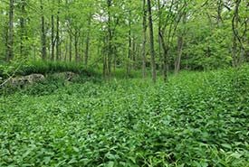
Invasive dog-strangling vine (Photo by NCC)
In my previous blog, I defined the term baseline inventory, described the behind-the-scenes planning stages, and laid out how we classify vegetation communities on the ground. Read on to find out what other important data we collect in the field, and how it all comes together to create a baseline inventory.
Step 2b: Species
While we collect information about vegetation communities, we also look for species. Usually, it’s one person’s job to carry the field book and write down the species that the team calls out as we walk. We record everything from plants, to birds, to mammals to get a good feeling for the site (and help with the vegetation community classification), but our species focus is on species at risk and invasive species.
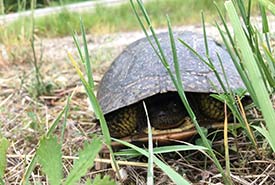
Blanding’s turtle, a species at risk (Photo by NCC)
We need to know what species at risk are on the property to be able to protect them. Our GIS department may have historical records of when a species at risk was seen on the property in the past, but usually we have to find them on the ground. There are some clues we use. If we’re walking through a forest in the Frontenac Arch, we keep our eyes peeled for gray ratsnakes. But if we’re exploring a wetland, turtles are on our mind. Some observations are incidental, like when we’re walking from one vegetation community to another and hear an eastern wood-pewee calling, but others are more targeted.
Invasive species are also recorded. If we come across a patch of garlic mustard or dog-strangling vine, it gets recorded so that we can make an action to control it.
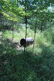
Historical dump sites, like this metal barrel, are common in eastern Ontario. (Photo by NCC)
Step 2c: Anthropogenic features
Not everything found in the ecosystem grew there. Centuries of human interaction on the landscape have left behind marks. Fences, trails, old foundations and dump sites are just some of the anthropogenic features found on new properties. Some of these are positive, like finding a great trail system that can be opened up for the public to sustainably enjoy, but others need to be managed. Historical dump sites are common in eastern Ontario, but if we know where they are, we can work to remove them and clean up the landscape.
Step 3: Get writing
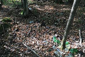
Dump site with bottles and cans (Photo by NCC)
Writing reports is typically a winter activity. There are only so many days in the Canadian climate that I can be outside doing field work, so when it’s freezing rain outside, I’m happy to curl up with a mug of tea and remember that one day things will be green again. This means I have to take detailed notes during the baseline inventory process and load all the information into our database. Every species, vegetation community and anthropogenic (human-made) feature is tracked, and any pictures or notes we’ve taken also get uploaded. The baseline inventory document includes the history of the property, driving directions, vegetation communities, species at risk, invasive species and human-made features.
Unlike a property management plan, which gets updated every five years, the baseline inventory is static. but that doesn’t mean it’s not useful. Because it shows a snapshot in time, we can use it to compare our progress. Knowing things like “when we first mapped the garlic mustard it was 1,000 square metres, but after five years of treatment there are only 200 square metres” is very valuable. We can watch the progress of forest restoration, and see landscapes shift over time. Although we look to the future when it comes to conservation, tools like baseline inventories allow us to see where we started. I have three baseline inventories to complete in 2020, and I’m excited to see which property will become my new favourite.


